The Amazing Evidence
Breaking New Evidence
Reasons to Believe (2/2021) – reports that astronomer James Green and his research team in Science Advances recently discovered that the magnetic fields of the Moon and Earth temporarily merged approximately four billion years ago (our earth and moon are calculated to have emerged about 5 to 5.5 billion years ago), forming a “coupled magnetosphere”. CLICK HERE TO CONTINUE

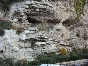
Jerusalem where Jesus was crucified
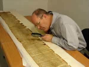
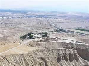
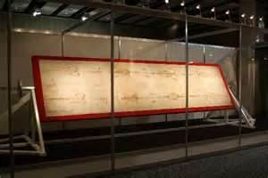
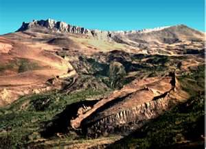
the Turkish government near Mt. Ararat, Turkey
Chapter 3 - page 2
Amazing Archeological Discoveries
You alone are the Lord; You have made heaven, the heaven of heavens, with all their host, the earth and everything on it, the seas and all that is in them, and You preserve them all. The host of heaven worships You. (Nehemiah 9: 6)
The True Route of Exodus
In 1978 Ron Wyatt and his team investigated an area on the Sinai Peninsula next to the Gulf of Aqaba, a part of the Red Sea between the Sinai Peninsula and Saudi Arabia. His archeological studies led him to believe that this area may have been the possible crossing site of the Israelites during Exodus. What made Ron think this was a possibility? In an earlier trip made to the area, he found a Phoenician style column on the beach area of Sinai facing the western shore of Saudi Arabia where inscriptions on the column were not legible due to water erosion. However, a similar second column was found on the shoreline directly across the Gulf of Aqaba in Saudi Arabia that he discovered in a later visit. On this column the inscriptions were legible and translated from Hebrew read, “Pharaoh, Mizraim (which means Egypt), Moses, death, Edom, Yahweh (God) and Solomon. Based on the age of the columns, it was concluded that Solomon most likely erected them as a tribute to the Red Sea crossing.
General opinion has it that the Exodus took place through the Sinai Peninsula, with Moses and the Israelites possibly crossing the lake/river area of Bitter Lakes where the Suez Canal now exists. From there Moses and the Israelites came to the area of Mt. Sinai in the mid-southern area of the Sinai Peninsula. The main problem with this proposed route is that Moses and the Israelites never cross the Red Sea proper. Secondly, it is in direct conflict with the Bible which does not reference Mt. Sinai as being in the Sinai Peninsula, but rather in Arabia as noted in Galatians 4: 25 (on the right) is specifically known as the land of Midian, which today is Saudi Arabia. In fact, the geographical boundaries of Old Testament times will reveal the area of what is today Saudi Arabia is Midian. Moreover, we also read in the Old Testament that Moses was exiled to the land of Midian, where Mt. Horeb (or Mt. Sinai) in reality is located as noted in Exodus 3:1.
However, the most awesome evidence indicating that the crossing took place at the Gulf of Aqaba between the Sinai Peninsula and Saudi Arabia occurred when Ron and his two sons scuba dove into the waters near the column. Where they dove they found underwater chariot parts such as wheels, axles, cabs and even an inlaid gold veneer decoration to a 4-spoked chariot wheel. But that was not all. Also found were the skeletal remains of horses and humans, preserved by coral encrustation. Most revealing was an intact rib cage of a human found underwater, all in the Gulf of Aqaba. Ron presented the hub of another chariot wheel consisting of 8 spokes to Nassif Mohammed Hassan, the director of Antiquities for Egyptian Archeology. Mr. Hassan immediately explained that the 8-spoked wheel was specific to the 18th Egyptian Dynasty, exactly around the time of the Exodus.10
Analysis of the geography also supported this area being the site of the Red Sea crossing. In surveying depth charts, it was found that this was the only possible location where the Gulf of Aqaba could be crossed. Except for this one site, the topography of the gulf is similar to an underwater gorge, with steep inclines and drop – offs reaching an average depth of 5,000 ft., nearly one mile down! If the water were removed from the gulf it would look like the Grand Canyon. However, at the site between the two columns, the underwater channel slowly drops off at a negotiable grade of 6%. The lowest point of this underwater bridge, being in the middle, is only 1,000 ft. Moreover, only at this site and across the Gulf of Aqaba is a beach area large enough to accommodate the estimated 3 million Israelites with their goods and herds. Nowhere else is such a large area found, as points north and south on both east and west shores are much too rugged and mountainous to contain such a large contingency of people.
It should be noted that corroboration of the initial discovery of the true route of the Exodus made by Ron Wyatt was confirmed by research conducted by Dr. Lennart Moller from the Karolinska Institute in Stockholm, Sweden. Beginning in the year 2000, Dr. Moller set out to duplicate the route which was advanced by Ron. In underwater exploration, the Moller expedition confirmed not only the land bridge that existed between Nuweiba, Egypt in the Red Sea but also artifacts such as chariot wheels, axles as well as corralized skeletal remains which Ron had discoverd approximately 13 years earlier.11
On the north end of the eastern beach (in Egypt) are the remains of an ancient Egyptian fortress which Ron believes best describes the location of Pihahiroth. Then across the gulf, on the Saudi Arabian side, there exists the restored remains of a large Midianite fortress which could well be Baalzephon. The phrase “over against” in English means “opposite of”, and may mean across the body of water where the Israelites were encamped.
After Pharaoh and his troops attempted to chase the Hebrews across the Red Sea, the Israelites were saved from annihilation. The Egyptians were drowned by God as He allowed the waters of the Red Sea to collapse upon them. Leading out from this site on the eastern beach in Saudi Arabia was a very large wadi that could easily allow thousands of Israelites out from the large beach area. The first landmark Wyatt’s research team came to as they headed east were twelve water wells with numerous palm trees growing around it. This place was a true oasis, as the surrounding area is total desert. This area perfectly fits the biblical description of Elim as stated in Exodus 15:27 with its twelve wells and almost 70 palm trees. Even to this day there are twelve wells and numerous palm trees noted on previous page.
It was noted that the wells had recently been walled by the nomadic Bedouins that frequent the area. The Wyatt team must have been in awe as the accumulation of all the evidence was pointing to this area as the actual route of Exodus, the very land that Moses and the Israelites had traveled over 3,000 years ago! Most important was that this evidence was proving the Israeli exodus out of Egypt and the Bible true!
Mt. Sinai – Jabel al Lawz
As the Wyatt team traveled east from Elim, about 16 miles from the original beach-head where the Israelites landed in Saudi Arabia, they came upon a large solitary rock standing some 60 feet upright in the air. What made this upright boulder so unique is that it was split in the middle. Most revealing was evidence that water had come forth from within the plit of the rock, as erosion of the surrounding rocky ground and many old stream beds could be seen. The Wyatt team realized they were at Rephidim, the place where Moses struck the rock with his staff and caused water to come forth for the Israelites as given in Exodus 17:1 & 6.
This was the last known encampment of the Israelites before their arrival at Mt. Horeb, otherwise known as Mt. Sinai. During their encampment the Israelites were attacked by the Amalekites. It is noted in the Bible that as Moses held his hand up during the battle, the Israelites prevailed whereas when he let them down, the Amalekites prevailed. So, both Ben – Hur and Aaron the priest held up the arms of Moses unto victory. Near the split rock of Rephidim, the Wyatt team found a large rectangular rock altar unquestionably made with human hands, again written about in Exodus 17:15-16.
Proof of it being an altar is evidenced by the solid construction throughout and that the stones were uncut, as commanded in Exodus 20:25. Also, circular piles of stones for either flocks of animals or shelters for the Israelites were found nearby, indicating the Israelite encampment at this site. There can be no doubt that the Lord God preserved these sites for our benefit.
From the site at Rephidim, the Wyatt team could make out the largest peak in the mountain range found in northwest Saudi Arabia, named Jabel al Lawz. What is so unusual about this peak is that the top of it is blackened, as though charred by fire and smoke. No other peak is similar in this area of Saudia Arabia. There exist no known volcanic sites in Saudi Arabia. Coincidentally, the inhabitants of this region call this mountain ”Jabel Musa”, which means “The mountains mountains of Moses” as stated in Exodus 19:18.
As mentioned previously, the traditional site of Mt. Sinai is located in the middle southern portion of the Sinai Peninsula, Egypt. This area was returned to Egypt in 1993 via the Oslo Peace Accords and was not identified as Mt. Sinai until nearly 2,000 years after the Exodus. First, the “Interpreter’s Dictionary of the Bible” notes on pg. 376 that, “The origin of the present Monastery of St. Catherine on the northwest slope of Jebel Musa is traced back to A.D. 527, when emperor Justinian established it on the site where Helena, mother of Constantine the Great, had erected a small church two centuries earlier.” This clearly indicates the site was established solely under orders of Justinian. Secondly, the “Jewish Encyclopedia”, Vol. 14, pg. 1,599 states, “There is no tradition of the geographical location of Mt. Sinai; it seems that its exact location was obscure already in the time of the monarchy.” Lastly and most revealing is an account given by Danish explorer Von Haven in an expedition he led that took place from 1761-1767. He concludes, “I have observed earlier that we could not possibly be at Mount Sinai. The monastery (of St. Catherine) was situated in a narrow valley, which was not even large enough for a medium-sized army to be able to camp in, let alone the 600,000 men that Moses had with him, who, together with their wives and children, must have come to over 3 million.” (reported in Arabia Felix: the Danish Expedition of 1971-1767, by Thorkild Hansen). Lastly, there is no geographical nor archeological evidence to support this area as Mt. Horeb.”12
As the Wyatt team entered the Mt. Horeb precinct in Saudi Arabia, it could be seen that there was an amphitheater effect produced by Jabel al Lawz and its associated hills. In this respect, the peak of Jabel al Lawz could be likened to the press box of the amphitheater, with its associated hills forming a horseshoe effect pointing east. Within the interior area of the bowl (or horseshoe) was the holy precinct, which was an area bounded by columns Moses had built. Also within the holy precinct are 12 pillars and another altar built by Moses. More recent construction found in this area includes the remains of a white marble shrine, guard house and fence built by the Saudis. In 1985 Ron Wyatt showed Saudi archeologists this site. Shortly thereafter a guard house and fence were erected by the Saudi’s, located directly in front of the holy precinct from the area where the Israelites lived. The area where the Israelites dwelled would represent the area in front of the amphitheater, similar to a large parking lot in today’s stadiums. The bounds separated the holy precinct from the parking lot so to speak (note the pillars as shown on the picture, a part of the holy precinct).
The mounds that had been built to separate this area could still be made out. At the site, Wyatt and his team witnessed the makeup of one of the columns as the Saudis excavated one of the bounds. Each bound is constructed as an 18 foot diameter round column with an outer wall of brick sized rocks and inner wall of the same. Although 3,400 years of erosion have covered most of them with soil and rock, the tops can still be seen on a few of them. Also found within the holy precinct was an altar directly at the front foot of Jabel al Lawz. This altar fits the biblical description given in Exodus 20:25 as no tools were used to shape the stones which constituted it. Lastly, a group of 12 pillar stones could be made out just to the north of the bounds, still within the holy precinct. Each of the stones was extremely large, being approximately six feet wide and nine feet tall. The 12 pillars were built for the reason given in Exodus 24:4.
As Ron and the team looked directly westward from the dwelling area of the Israelites, toward the blackened peak of Jabel al Lawz, they could make out a lone tree on the forward ridge of Jabel al Lawz. Directly below this tree and two granite boulders they could see a large cave. This was direct proof of the mountain being Mt. Horeb, since the Bible specifically states that Elijah the prophet stayed in a cave at Mt. Horeb as given in 1 Kings 19: 9-10.
Then, between the summit mount of Jabel al Lawz and the cave, there exists a plateau. This plateau is large enough to have held Moses, Aaron, Nadab, Abihu and the seventy elders as given in Exodus 24:1. Upon this plateau, one can overlook the vast “amphitheater” area occupied by the Israelites to the east. Directly below is the holy precinct as outlined by the bounds and chain link fence which was erected by the Saudis. Looking slightly to the southeast, one can see another altar. This altar is the most revealing and confirming evidence that Jabel al Lawz is in fact Mt. Horeb/Mt. Sinai. In a separately fenced area which again the Saudis put up, there exists an altar which is partly torn down. Painted upon its rocks are twelve petroglyphs of Egyptian bulls and cows. Archeologists have noted that the artistic rendering of these bulls and cows are distinctly Egyptian! Nowhere else can they be found in Saudi Arabia, as the styles of their horns and the shapes of the bulls/cows are identical to those only found on Egyptian temples and tombs.”13 Not only that, but a reading of a molecular frequency generator over the area revealed a positive gold reading. This immediately registered in Ron’s mind that this had to be the location of the golden calf. The ability of this instrument to detect concentrations of different metals was tested by the Saudis who accompanied the Wyatt team. They buried their gold rings and would easily find them using the instrument.14 Such significant and unquestionable proof conclusively determined this area to be the true site of Mt. Sinai and the Israelite Exodus as written in the Holy Bible.
Next to the altar near the face of Mt. Horeb is evidence of an ancient river or brook that originated from the plateau just below Mt. Horeb, spilling down the face of the remaining part of the mountain and into the holy precinct. In the book of Deuteronomy we can read what became of the golden calf.
Near the altar and just north of the brook within the holy precinct is the remains of a shrine that was made of pure white, polished marble. The remains indicate that it was round with 6 sets of double columns supporting a dome. From the inscriptions he saw, Ron believed this shrine was erected in the time of Solomon, possibly at the same time the two columns on the two beaches were erected. Additional artifacts found in the plain area included pieces of millstones attesting that a large group of people ground food for their use. In fact, Numbers 11:8 states that manna which God rained down from heaven had to be ground for consumption.15
Ron and his team marveled how the Lord had preserved this site throughout its nearly 3,500 years of history gone by. They believed if the true location had been known all along, there would be no evidence left for the world to see. It has been left and discovered at such a time as this, when a majority of the world’s population does not believe in the Red Sea crossing of the Israelites let alone the Bible that records it. Now, we now have concrete proof that God brought forth the Israelites, not as a fictional story in a book called Exodus, but of a true account written by Moses as found in the Bible.
Ron Wyatt passed away in the year of 1999. When the world was informed of these most incredible discoveries, many detractors and charlatans came along to make these established discoveries appear as though they came from their own or were claimed as frauds. Worse yet was to see a number of individuals come forth to deny or appropriately give credit to Ron as the individual responsible for discovering these sites as you have just read, sadly with a number of them taking credit for his discoveries.
Having deeply researched this material and having spoken to individuals who have either worked directly with Ron or have known him personally, he was truly a humble man who wanted to share this information with all that would listen for the glory of God. Sadly, in so doing, many took advantage of his humble and trusting personality. As it now stands, I am completely convinced that Ron is now enjoying the full benefits of living a life of glory in heaven. Although I had never had an opportunity to meet Ron, I most certainly look forward to doing so when I am called to glory. (NEXT CHAPTER)
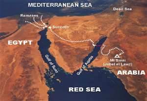
“For this Agar is Mount Sinai in Arabia, and answereth to Jerusalem which now is, and is in bondage with her children”. (Galatians 4:25)
“Now when Pharaoh heard this thing, he sought to slay Moses. But Moses fled from the face of Pharaoh, and dwelt in the land of Midian: and he sat down by a well. Now Moses kept the flock of Jethro his father, the priest of Midian; and he led the flock to the backside of the desert, and came to the mountain of God, even to Horeb.” (Exodus 3:1)
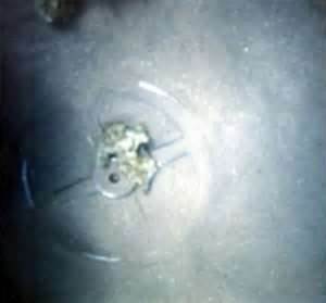
Gold inlaid remains of chariot wheel found at Red Sea crossing.
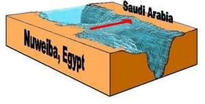
Bariometric picture showing the land bridge across the Red Sea. It is the only location in the entire Red Sea where the Exodus could have occurred.
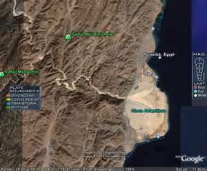
Large flat beach area directly in front of land bridge in the Gulf of Aqaba, Red Sea.
“Speak unto the children of Israel, that they turn and encamp before Pihahiroth (Pie-ha-he-roth), between Migdol and the sea, over against Baalzephon: before it shall you encamp by the sea.” (Exodus 14:2)
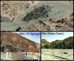
Site of Elim in Saudia Arabia which still has 12 water wells to this day! What a confirmation!!!
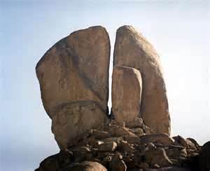
Location of Rephidem found, the rock which Moses struck for water.
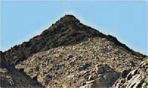
The real Mt. Sinai, Jabel al Lawz, found in Saudia Arabia. Note blackened peak.
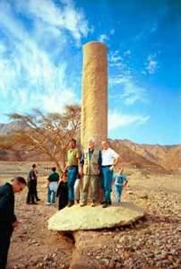
Column placed by King Solomon indicating location of Red Sea crossing. Shown is Ron Wyatt with research team.
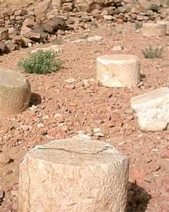
Marble pillar stones found at Mt. Sinai, indicating the holy precinct, just as described in the Bible. Symetrical round design indicates it is man-made.
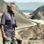
The late Ron Wyatt next to Sinai Peninsula wadi near Newieba before the beach area .
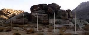
Location where it is believed the golden calf was erected since this has been identified as an alter with petroglyphs as shown below.
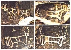
Petroglyphs of bulls and cows that are identical to those seen on Egyptian art or other Egyptian sources.
“So all the people took off the rings of gold that were in their ears and brought them to Aaron. And he received the gold from their hand and fashioned it with a graving tool and made a golden calf. And they said, “These are your gods, O Israel, who brought you up out of the land of Egypt!” (Exodus 32:3-4)
“Then I (Moses) took the sinful thing, the calf that you had made, and burned it with fire and crushed it, grinding it very small, until it was as fine as dust. And I threw the dust of it into the brook that ran down from the mountain. (Deut. 9:21)
“And the manna was as coriander seed, and the color thereof as the color of bedellium. And the people went about, and gathered it, and ground it in mills, or beat it in a mortar and baked it in pans….” (Num. 11:8)